
The second subperiod identified by Anderson was the Middle Paleoindian period. This period was characterized by a number of fluted and unfluted points, both larger and smaller than Clovis points. During this subperiod, massive extinctions of such animals as elephants, horses, camels, and other megafauna took place, and plant communities shifted location and composition in dramatic fashion. In north Georgia a spruce/pine boreal forest was replaced by northern hardwoods (oak, hickory, beech, birch, and elm), which in turn gave way to modern plant communities. Southern Georgia had an oak-hickory hardwood canopy that may have been in place throughout much of the previous glacial cycle. By the close of the Paleoindian Period, around 9000 or 8000 B.C., sea level was within a few meters of its present elevation, and climate and biota approached modern conditions. Only during the mid-Holocene (ca. 6000-2000 B.C.), however, did southern pine communities and extensive riverine cypress swamps begin to emerge in the Coastal Plain.
Most likely, Paleoindians moved over large areas, on foot or by water, in small bands of twenty-five to fifty people. Their group ranges centered on stone quarries, shoals, or other particularly desirable environmental features. Of the more than 32,000 sites recorded in Georgia state archaeological site files by the year 2000, fewer than 200 have evidence for a Paleoindian occupation. These sites remain rare and, when found, should be protected. Although it is known they were hunter-gatherers, it is not known whether their diet primarily consisted of large game animals or a wide array of plant and animal species. In some parts of the country these people targeted elephants and other large game, but no evidence for this has yet been found in Georgia.
Concentration on specific zones and resources may account for the variation in the stone points of this subperiod. Mapping the distribution of the various types of projectile points may help us see how these various zones and resources were used. This has been done here on a limited scale using more than 1000 Paleoindian point examples documented by Jerald Ledbetter for the SGA as a source document.
The point types of this subperiod in the Southeast are Cumberland, Redstone, Suwannee, Beaver Lake, Quad, and Simpson. This subperiod is viewed as a time when the population was adapting to optimum environmental resource zones instead of randomly moving throughout the Southeast, perhaps following heards of mammoths or mastodons.
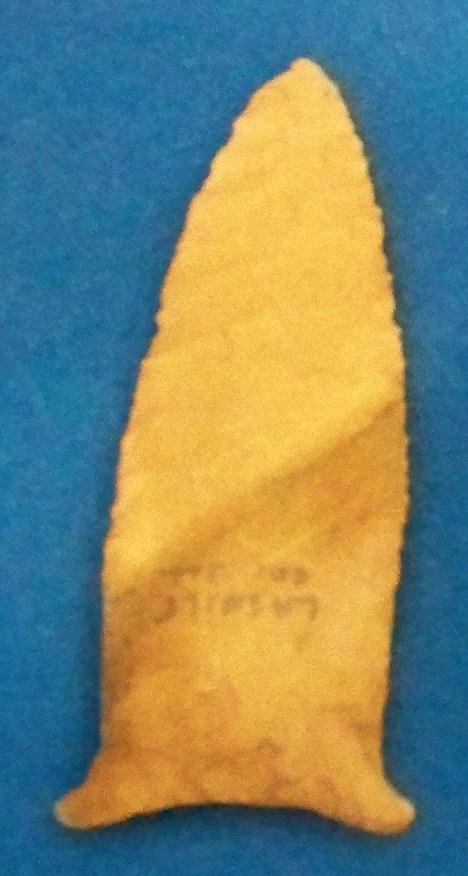
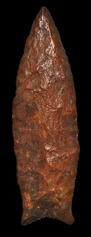
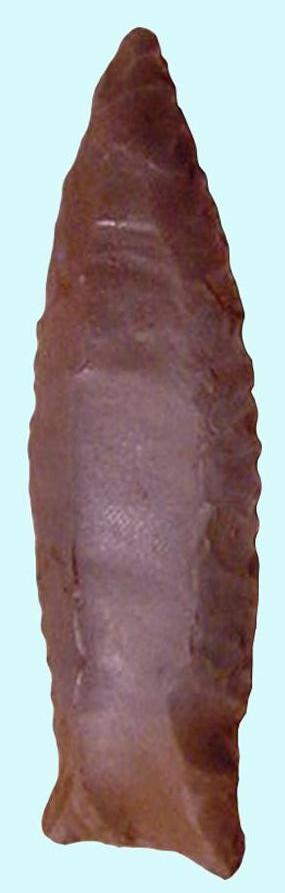
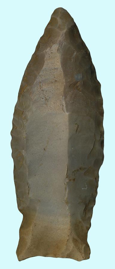
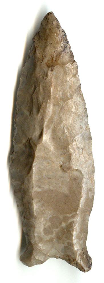
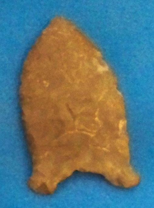
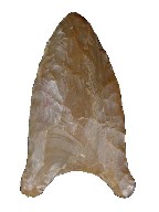
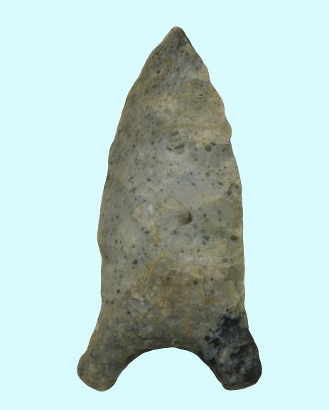
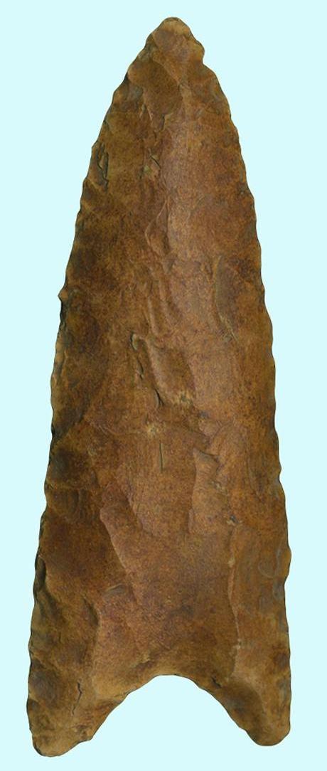
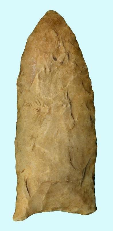
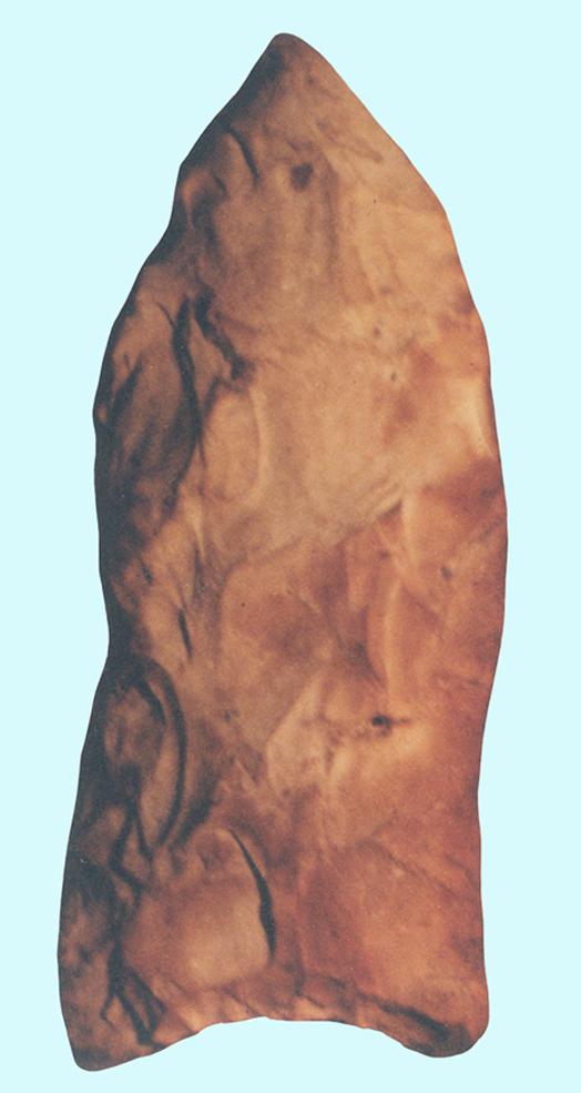
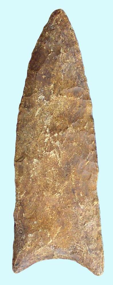
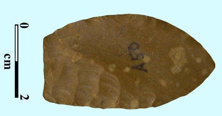
Figure 1.9: Beaver Lake Points from Florida, Alabama, and Georgia
The Beaver Lake point was named for the Beaver Lake area of Limestone County, Alabama.[i] The name was applied to Florida examples by Ripley Bullen[ii] because of their similarities to the Alabama type.
While Florida and Alabama Beaver Lake points share a similar general appearance, size differences set them apart. The Florida Beaver Lake (Figure 1.9a-c) is a small to medium sized lanceolate blade measuring 1.5 to 2.25 inches in length and .6 to .75 inches in width. The blade is less than .25 inch thick. Alabama types are larger, measuring 1.75 to 2.5 inches long and are proportionately wider and thicker. Size is again important as it differentiates the Florida Beaver Lake from the yet smaller and narrower Manasota point used during the Early Woodland period. The blade of the Florida Beaver Lake is developed through controlled percussion and pressure flaking that forms a lenticular cross section.
The excurvate edges of the blade meet at an acuminate distal end and are widest at the blade’s midpoint. The blade edges continue through the hafting area that is slightly waisted just above the basal ear. Light smoothing is typical along the sides of the hafting area. The basal corners or ears are slight in most examples and point out straight to slightly downward. Basal thinning flakes, normally present, may appear to be one or several small flutes. The basal edge is straight to slightly concave and is normally lightly smoothed.
The cultural context of the Alabama Beaver Lake is clear having been recovered from the lowest cultural-bearing levels of the Stanfield-Worley Bluff Shelter dating to 10,000 years BP. Unfortunately, their context in Georgia has not been so clearly defined. Several examples have come from northwestern Georgia and the Oconee River area, but not from a secure context.
Rick Dreves reported another recovery from the old shoreline of Lake Apopka in Orange County, Florida. The example was recovered from unit C6, stratum 2, lower portion. The soil was a blackened ash and sand mix that might correspond to hardpan. Mr. Ben Waller identified the example.[iv] Other recoveries have been primarily from a river context. One extremely patinated example was recovered from the Johnson’s Lake site in Marion County, Florida. Examples of later period points of similar material in the site were far less patinated, indicating the antiquity of the Beaver Lake. Finally, two examples in the Beilman collection were recovered from the Nalcrest site, which also produced a Suwannee point.[v]
The distribution pattern of the Beaver Lake may be evidence of its antiquity as it shares the same general distribution as other late Paleoindian and Dalton period points along the central Gulf Coast to the rivers of north-central and northwestern Georgia.
The Cumberland point was named for the Cumberland River Valley in Tennessee. These points were recovered with Big Sandy points and classic Dalton forms at the lowest levels of the University of Alabama site and are considered part of the Middle Paleoindian period dating sometime prior to 10,000 years BP.
Cumberland points are characterized by their distinctive flute that extends from the basal edge to the distal end of the point. The blade edges are excurvate and meet at an acute distal end. The blade edges are pressure flaked. The hafting area is waisted similar to the Simpson point. The basal ears flare widely, at times almost to a shallow concave basal edge, while in other examples the basal edge is deeply concave. The basal edge is heavily smoothed.
Cumberland points are rare in Georgia with less than a handful of examples that are normally found above Georgia’s Fall Line.
The Quad point was named by Frank J. Soday and James Cambron for examples found on or near the Quad site in Limestone County, Alabama. Soday and Cambron had done a survey of Paleoindian sites and related points in the Tennessee River Valley and Soday had done excavations at the Quad site, a Paleoindian village site, reporting his findings in the Tennessee Archaeologist, Vol.10, No.1 in 1954. The unfluted variety was described by Robert E. Bell in 1960.
The Quad is a medium-sized, broad, fluted or unfluted point with an expanded-rounded, auriculate hafting area. Fifty-one examples were collected from thirty-one sites that measured between 86 and 47mm in length with an average length of 57mm and an average width of 23mm.The cross-section may be flattened or lenticular.
The blade is developed by random or collateral flaking. Blade edges are often straight in the hafting area and convex above the hafting area to an acute distal end. Short, fairly deep flaking is found along the edges of the blade. The base is incurvate and may be fluted. Because of the thickness of these points, fluted examples have short flutes similar to Clovis points. The basal edge and especially the sides of the hafting are usually smoothed.
Bell concluded from Tennessee and Ohio examples that the points dated between 6000 and 10,000 B.P. Cambron.
recovered examples from the University of Alabama site, Level 11, with Wheeler, Cumberland, Dalton and Paint Rock Valley points that led him to suggest a date of 10,000 B.P. or earlier.
Joffre Coe found similar points with Dalton points at the lower levels of the Hardaway site in Piedmont, North Carolina. Examples have also been recovered in northwestern Georgia, Kentucky and Ohio.
Edward C. Mahan named the Redstone point for Redstone Arsenal in Huntsville, Alabama where examples were recovered from the Brosemer site.
The Redstone is a medium to large triangular fluted point measuring between 67 and 117mm in length. The sides of the blade are slightly convex with its widest point at the basal corners. Flaking is random with a long flute that runs from the base of the point nearly to the distal end in most cases. Basal ears are typically rounded. Basal and lateral smoothing is present along the basal edge and about 1/3 the length of the blade.
The Redstone is believed to be a variant of the Clovis type and would date accordingly. Cambron and Hulse suggested a date of 15,000 years, although dates as early as 42,000 have been recovered from assumed Clovis hearths. There are a variety of differing opinions as to the age of this type. Many archaeologists place this type as a descendent of the Clovis that developed into the Beaver Lake point. Given its characteristics and its associations, this seems to be the most appropriate placement.
The general area of distribution extends along the Tennessee Valley from northern Alabama and southern Tennessee. Examples in Georgia are rare, the majority of which are recovered above Georgia’s Fall Line.

Ripley P. Bullen named the Simpson point[vi] for examples found in the J. Clarence Simpson collection at the Florida Museum of Natural History in Gainesville, Florida.
The classic Type 1 Simpson (Figure 1.4a) is a lanceolate style point measuring 2.5 to over 5 inches in length. The blade expands abruptly from the hafting area to its maximum width at the midpoint of the blade. The blade is formed by broad, random percussion flaking with fine pressure flaking along the edges that meet at an acute distal end. The blade cross section is thin in comparison to the Clovis or Suwannee types. The extreme flare of the blade and the auricle amplifies the waisted appearance of the hafting area. This feature has been described as “Mae West” in appearance.[vii] The sides of the hafting area are smoothed from the end of the auricle to the base of the blade. The auricle of the classic Simpson expands down and outward further and is much narrower than the Suwannee point. The expanding feature of the auricle does not appear in examples of the Type 2 Simpson (Figure 1.4b) sometimes referred to as the “Bull Tongue” type, giving the hafting area a very straight-sided appearance. The basal edge of all Simpson subtypes is commonly deeply concave and thinned. Thinning flakes in the basal portion of the basal edge may reach well up into the hafting area and resemble short flutes. The basal edge is typically heavily smoothed.
Regional variants of the classic type 1 Simpson from across the state have three major distinctions. The blade of the Chipola River examples is comparatively wider and thinner than those of other areas. Tampa variants frequently display a wider basal flare that other classic examples. The Santa Fe River variants tend to be more Clovis-like in appearance with a broader hafting area, thus reducing the appearance of the blade flare.
The Type 3 or “Sunfish Simpson” (Figure 1.5) is extremely large, measuring almost 7 inches in length. Three of the six or so known examples in Florida are from the Chipola River Valley and were illustrated by H.L. Chason in his book Treasures of the Chipola River Valley. These large blades may represent the prototype for the Simpson point in an un-resharpened state. Rejuvenation seems to be present first at the widest point of the blade where, in an unrejuvenated state, they can equal almost half.
the length of the point. These blades also compare to the Fishtail points of Central and South America as part of a non-Clovis Paleoindian tradition.[viii]
Generally considered to be part of the Middle Paleoindian period and dating to at least 10,800 to 10,500 years BP,[ix] the appearance of Simpson points with Suwannee points at sites in the Harney Flats area and at the State Road 593 site in Pinellas County[x] supports the antiquity of the type. One Sunfish example was recovered from St. Augustine, Florida where M. Lucian Gause recovered a large blade from a gopher tortoise burrow. The point was resting in a layer of dark, compacted organic soil that Carl Halbirt, City Archaeologist, interpreted to be 11,000 year old pond muck.[xi]
Like other late Paleoindian period Points, the Simpson type is predominately found along the rivers of northern Florida and southern Georgia to the central Gulf Coast. They have been recovered as far south as Charlotte Harbor along Florida’s southwest Gulf Coast. The Gause recovery in St. Augustine, Florida gives rise to a potentially much wider distribution of the Sunfish as the first stage form of the type. The technology of this extremely wide, flattened blade may yet appear across the United States as it has already been identified in the Fishtail point of Central America.
John Goggin applied the name Suwannee to this point type, referring to the Suwannee River in north-central Florida.[xii] Goggin described the type as a “large stone point suggestive of Plainview forms.” It is difficult to determine if the name originated with him or was in common use at that time. Many examples have been recovered from the Suwannee River and throughout Florida.
The Suwannee point (Figure 1.3a-d) is a large lanceolate style point measuring 3 to 5 inches long. Its larger size distinguishes it from the smaller Quad point of Alabama. The blade of the Suwannee is formed with random flaking with retouching along the edges that meet at a broad distal end. The blade cross section is lenticular. The hafting area is only slightly waisted just above the basal corner in contrast to the strongly waisted Simpson point. The hafting area of larger specimens is frequently laterally thinned with percussion flaking all the way to the basal edge. Suwannee blades frequently display very heavy smoothing in the hafting area in comparison to other points of this period.
The basal corner expands downward and outward to equal the maximum width of the blade, but is rounded in contrast to the more pointed basal corner of the Clovis, the more pointed auricle of the Simpson types, or the squared and enlarged auricle of the Quad point.
The basal edge is concave, though not typically as deeply as the Simpson point, and heavily smoothed. Some smaller, well balanced examples recovered from the Tampa Bay area to as far north as Citrus County (Figure 1.3a) can display a more deeply concave basal edge and may have been used as projectiles rather than blades.
Ripley Bullen[xiii] placed the Suwannee point in the latter part of the Paleoindian period. He noted the possibility that it was present to a lesser degree in other states and might be considered by others to be a sub-variant of the Clovis or other Paleoindian types.
Their recovery at numerous sites in The Harney Flats area of Tampa Bay, estimated to date to 10,000 years BP[xiv]further supports the antiquity of the Suwannee point. Suwannee points are fairly rare in Georgia and share the same geographical distribution as Clovis points.
Tools recovered from sites that are associated with this period may include the Waller Knife, the Hendrix Scraper, Core or Turtleback Scrapers, Side Scrapers, Triangular End Scrapers, and Spoke Shaves, as well as the continued use of unifacially flaked as well as bifacially flaked knives, Gravers, Abraders, and other tools present in the Early Paleoindian period.
Ben Waller, an early diver instrumental in the unveiling of Florida’s Paleoindian history during the 1960;s and 1970s, discussed examples of this blade form taken from the Santa Fe River.[xv] Subsequently, the blade became known as the Waller Knife.
The Waller Knife is a medium-sized, unifacially-flaked blade measuring 1.3 to 2.4 inches in length. The blade is made from a large percussion flake during an early stage of core reduction. The flake is modified with uniform pressure flaking on only the dorsa or outside face. The ventral, or inside face is unworked, creating a plano-convex cross-section. The hafting area was developed through bifacial notching, although the term “hafting area” is most likely inappropriate as these knives were probably hung from a lanyard. Smoothing of the hafting area is not a characteristic of this type. Waller’s association of these blades with early kill sites and Ripley Bullen’s inclusion of them as part of the Nalcrest site tool kit would place them from 10,000 and the latter part of the Middle Paleoindian period to 7,500 years old as part of the Early Archaic period. The Waller Knife is included as part of the Bolen tool kit, having been recovered from the Little River site (8J2603) on the Aucilla River.[xvi] Their consistent occurrence in early megafauna kill sites indicates their use in the butchering process, probably for both cutting and scraping.
Waller’s discussion associates these blades with the Santa Fe River of central Florida. Other examples have been recovered throughout the north-central and Gulf Coastal areas of Florida and southern Georgia.
Barbra A. Purdy, Florida’s Prehistoric Stone Technology, University Presses of Florida, Gainesville, discussed the Hendrix scraper as having occurred in fairly large numbers in Florida’s Paleoindian sites and as having been reported as part of the Paleoindian stone tool assemblage at the Shoop and Bull Brook sites (Witthoft 1952; Byers 1954). Bullen (1958) and Bullen and Dolen (1959) picture these as part of the artifact recovery at the Bolen Bluff and Johnson Lake sites in Florida, indicating a span of use from perhaps the Middle Paleoindian period to the Early Archaic period. Warren (1973) discusses an identical specimen found at St. Petersburg, Florida.
The typical specimen weights 87.5 g and is 10.4 cm. long, 3.7 cm. wide, and is 2.2 cm. thick. Sizes ranged from 37 to 257.9 g in weight, 7.8 to 16.2 cm. in length, 3.1 to 6.1 cm. in width, and 1.7 to 4.0 cm. in thickness. All of the 33 examples studied showed use as scrapers, but 5 examples had also been used for piercing or cutting as well. Witthoft and Byers described these as side scrapers, but 24 of the Florida examples showed use around the entire circumference. The most intense use on 22 of the examples was along the left distal end of the tool. The tools took three basic shapes; ovate (4), ellipsoid (20), and triangular (9). All flaking had been percussion and the angle of the use edge was from 60 to 90 degrees. Eleven of the 33 examples had striking platforms, two of which were at the distal end of the tool. All examples were considered unifacial, but 14 examples had a small amount of flaking to thin the bulb of percussion or lessen the curve of the ventral face.
The core or “turtleback” scraper was also identified at the Stanfield-Worley site. H. Trawick Ward (1993) defined a core as a chunk of raw material from which two or more flakes have been purposefully detached. Cores may be the result of direct or bi-polar percussion. The examples of these cores that could be classified as scrapers from the Central Georgia Surface Survey were all the result of direct percussion. The core scraper is made from an exhausted core that has then had one or more sides modified through pressure flaking to create a scraping face. Core edges that remain unmodified retain their typical percussion flake scares.
The Central Georgia Surface Survey that included sites across 18 counties only produced 55 of these tools. The Pool Road Hill Top site that produced 17 of these examples contained predominately Early Archaic point types and pottery was virtually absent. The high number of these scrapers in a heavily Early Archaic context suggests that they, like other unifacial tools, were used extensively during the Late Paleoindian to Early Archaic periods. Gordon Willey[xvii]recovered a number of what he called “turtle-back” scrapers. While Willey did not define what he recovered, they were consistently recovered from sites that also contained Paleoindian and Early Archaic projectile points including the Safety Harbor site and the Parish Mound 3 site. Research done by James Cambron and David Hulse[xviii] on nine sites that included Paleoindian, Transitional Paleoindian, and Early Archaic materials and context along with examples of this scraper type support a Paleoindian and Early Archaic context.
Side scrapers were described at the Stanfield-Worley site as an otherwise unshaped flake that was worked to a scraping edge along one or more of its long edges. H. Trawick Ward, who recovered two of these scrapers from the Guthrie site in North Carolina, noted that these scrapers were used for hide scraping and cutting. In speaking of scrapers as a class of tools, Jerald Ledbetter further described scrapers as having deliberate unifacial retouch along an edge to produce a steep, convex working edge profile. He added that the shape of flake scrapers suggests that they could have been used as hand-held or possibly hafted tools that were meant for light-duty scraping. The location of scrapers in association to the Late Archaic pit house at the Mill Branch site suggested that they were used most often in a domestic setting. Other archaeologists have agreed with Ledbetter that these tools occur most frequently in household midden deposits.
The earliest recovery of side-scrapers was from the pre-Clovis layers in area B of the Cactus Hill site in Sussex County, Virginia where one example was recovered that measured 5.4 cm. long. The pressure flaking along one edge suggested use as a cutting or scraping tool. The sites surveyed in central Georgia contained 109 examples of the side-scraper. The highest number of these blades came from the Deep Creek site in Glasscock County where 12 blades were recovered. The site contained 42 Early Archaic point types, 135 Middle Archaic points, 162 Late Archaic points, 20 Woodland points, and 28 Mississippian to Historic period points. This high number of points from each archaeological period may suggest a consistent use of these blades from Early Archaic to Historic times. Examples recovered by Gordon Willey from the Safety Harbor Mound site demonstrate that these tools were heavily used as late as 1700 A.D.
These scrapers are courtesy of Mr. Leon Perry.
Ledbetter likened them to tool forms commonly attributed to the Paleoindian and Early Archaic periods, some of which may have continued in use into the Middle Archaic period. The context of Ledbetter’s recoveries appeared to have been Early Archaic. There were 115 examples of triangular end scrapers recovered during the Central Georgia Surface Survey, 20 of them from the Deep Creek site in Glasscock County, Georgia. The site contained an Early Paleoindian period Clovis point, two Dalton points, and forty-two Early Archaic points. Gordon Willey listed Triangular scrapers among those recovered from the Safety Harbor period Safety Harbor Mound site in Pinellas County, Florida. This mound remained in use until near the end of the recorded history of the Safety Harbor culture that ended in about 1725. It is entirely possible that the large numbers of scrapers recovered from the mound may be the result of mound fill taken from earlier sites.
The original definition given by David L. DeJarnette, Edward B. Kurjack, and James W. Cambron at the Stanfield-Worley site was “a concave side scraper.” H. Trawick Ward further defined this tool at the Jenerette site as a large reduction flake that has been worked along at least one edge to form a broad (15 to 17 mm.), shallow (3 to 4 mm.) concavity that is steeply beveled. The consensus of most archaeologists is that spokeshaves are made for working wood in a manner similar to the way a wood plane or draw knife might be used.
These examples are part of the Author’s collection and courtesy of Mr. Leon Perry.
Ward recovered three examples of spokeshaves from the Jenerette site. The other five sites where he recovered these tools contained only one example, all of which dated between the Late Woodland and Historic periods. The Central Georgia Surface Survey recovered only eight examples of spokeshaves and no site contained more than two examples. The variety of materials in those sites made any cultural context indistinguishable. Bennie Keel (1976) recovered one example from the Warren Wilson site in a historic Cherokee context, but William Webb (1951) did not recover any examples of spokeshaves from the Middle Woodland Copena and historic Creek sites in the Guntersville Basin of Alabama. The spokeshave was not listed among the Clovis age tool kit at the Gault site in central Texas, but one example was recovered by Carl Yahnig at the Little River site in Christian County, Kentucky. The example was an additional feature flaked into the side of a Clovis age end scraper.
Mr. Perry’s survey identified seven sites that were scattered among five counties that contained Middle Paleoindian points. While most of these sites were associated with the creeks and rivers of Georgia, not all of the environments inhabited by these early people were so obvious.
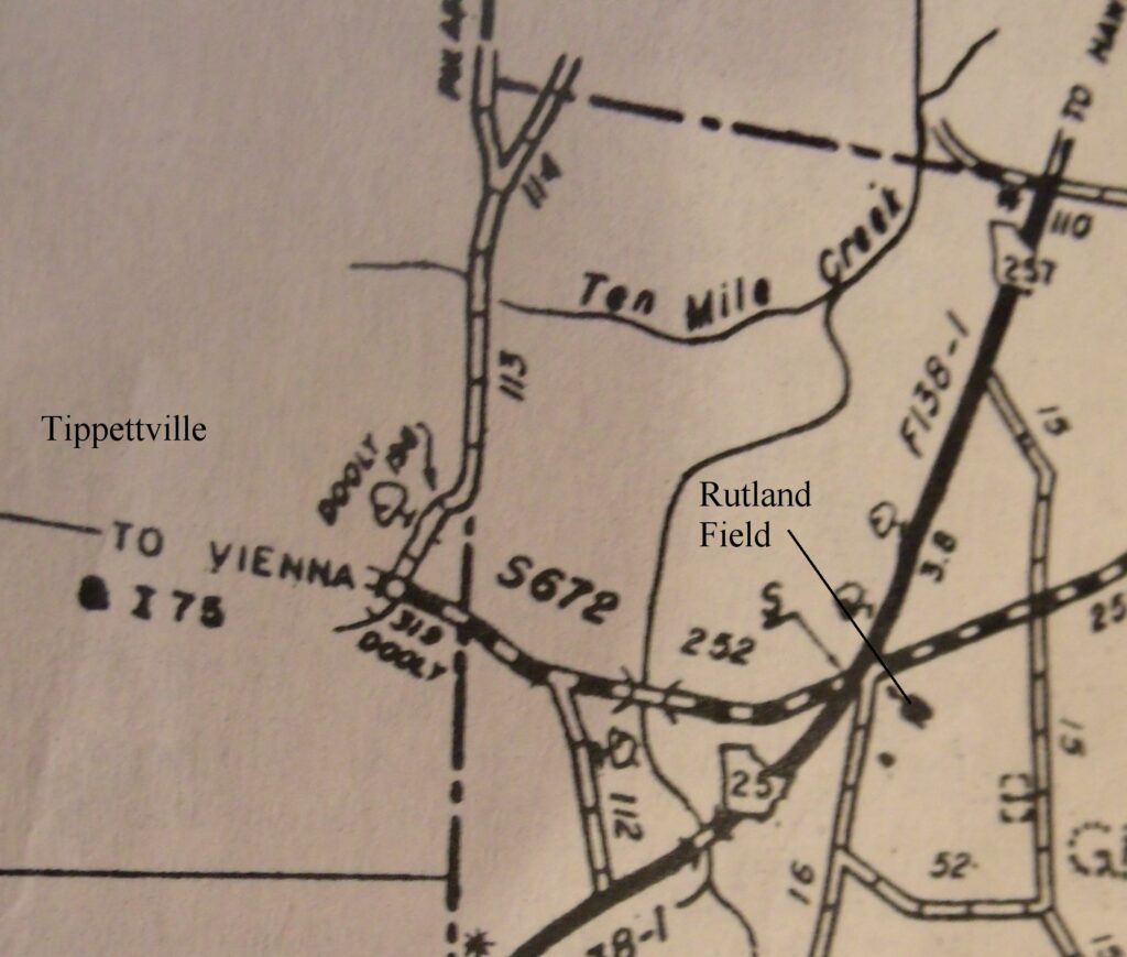
The Rutland Field site is located on the Rutland farm along and east of Georgia highway 257 near Tippetteville, Georgia in Wilcox County. The field was plowed when Mr. Perry had permission to do his surface collection. An intermittent waterway runs along the east side of the field and may have served as a water source for the site at earlier times. The only other waterway and source of fresh water was Ten Mile Creek which ran only a short distance northeast of the site.
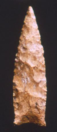
Mr. Perry’s surface survey of the site yielded 807 artifacts. Twelve of those artifacts dated to the Middle Paleoindian period. These consisted of the only point form, a broken Simpson/Suwannee-like preform (left) and eleven other tool forms that may have been associated with the site during that period.
Seven of those were Core or Turtleback scrapers (center), an abrader (right), a Hendrix Scraper (row 2 left), a prismatic blade (left center), an End Scraper – note the flaking pattern commonly used during this period (right center), and a Waller Knife (far right). Not all of these tools may have been used during this period as some of them were used from the Paleoindian to the Early Archaic period; however, the tools listed here had heavy patination.
The presence of these tools suggests base camp activities such as hide preparation and tool production. The unfinished point or blade is a final state preform with pressure flaked edges that closely resembles a blade with the same characteristics recovered from Burke County (below). Abraders were used to smooth the basal and lateral edges of these early points. Prismatic blades and Waller Knives were expedient tools used during the butchering process.
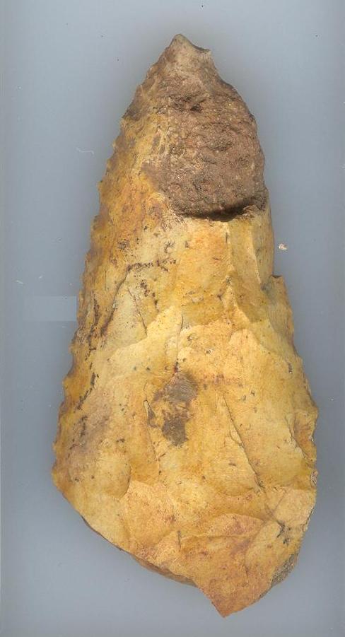
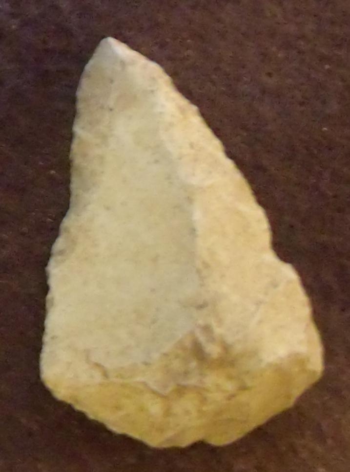
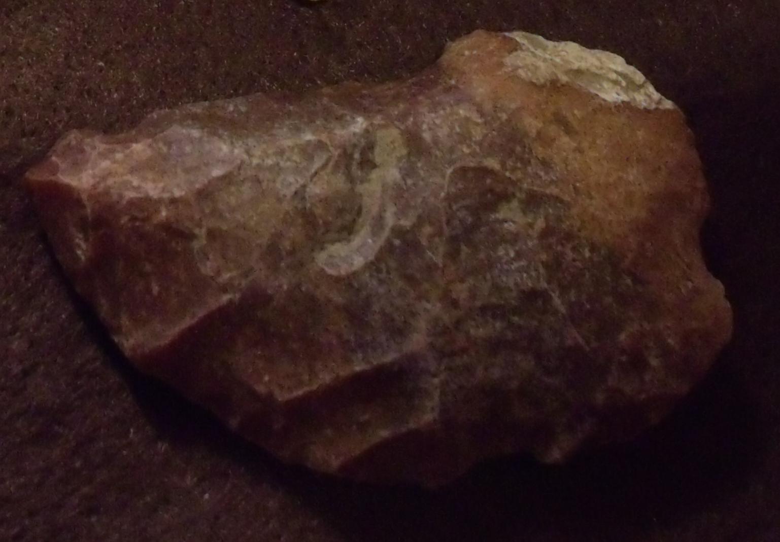
The Sun Hill Creek Site in Washington County mentioned above and that had produced a Clovis point during the Early Paleoindian period, had also yielded a Suwannee point from the Middle Paleoindian period and a single side scraper that also appears to have been associated with it from the same time period.
The Suwannee point (right) was identified by its horizontal thinning flakes across the hafting area and lateral and basal smoothing, although the blade lacked the typical concave basal edge. The blade measured about 2 inches in length and about 1.3 inches wide. Overshot flaking appears on at least one face of the point.
The Rutland Field site is located on the Rutland farm along and east of Georgia highway 257 near Tippetteville, Georgia in Wilcox County.
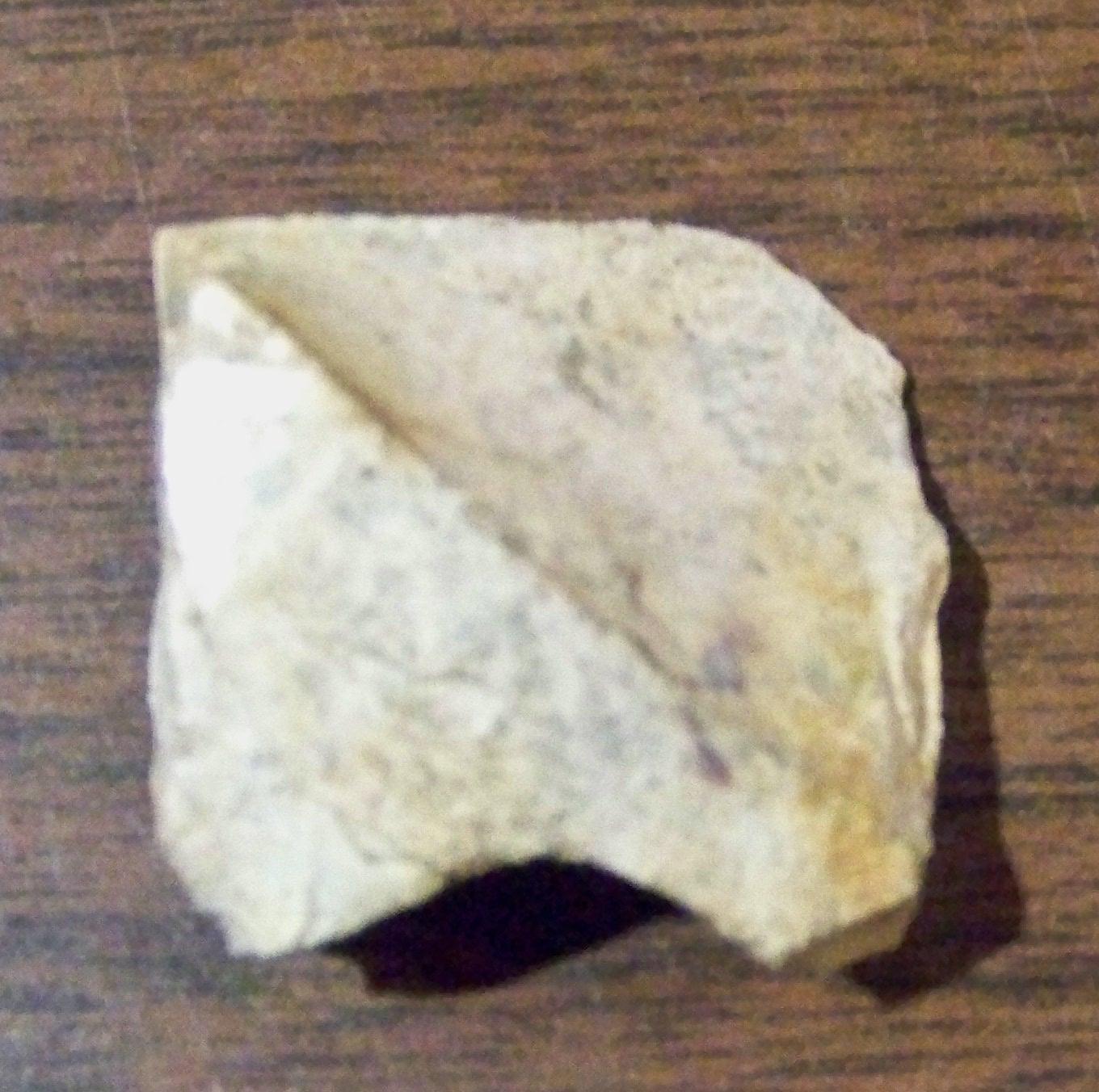
The Gum Swamp sites 1 and 2 were terrestrial sites located along Gum Swamp Creek in Dodge County, Georgia. The sites were plowed fields along the eastern edge of the swamp and west of Venson Power Road in the north-central part of the county. The surface collection from these two sites yielded 1,082 artifacts that represented archaeological time periods from the Paleoindian period dating as early as 10,800 RCYBP through the Mississippian period dating through A.D. 1650.
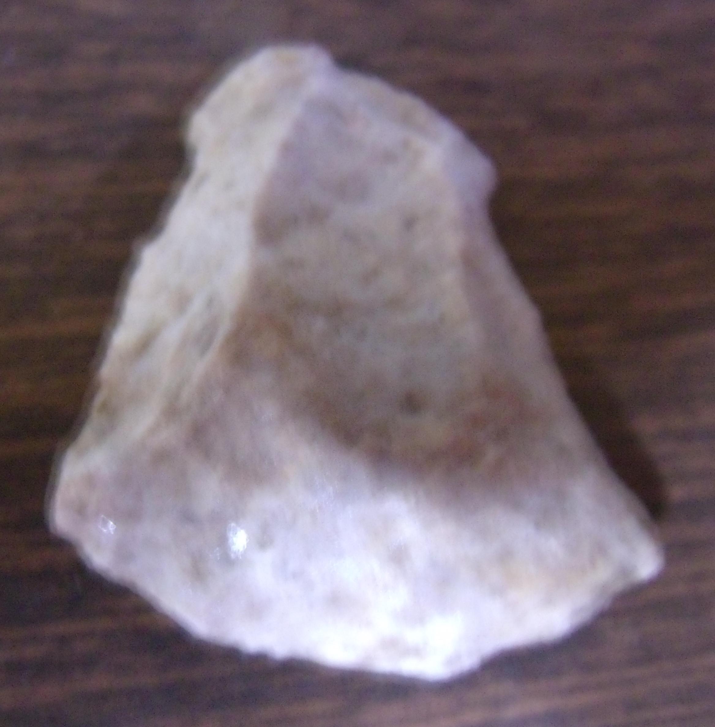
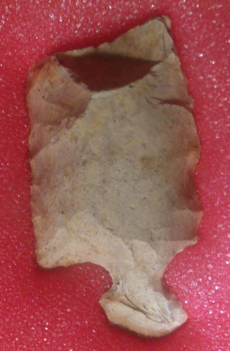
The singular blade/point type (left) recovery appeared to be an unfinished and broken basal portion of a Simpson-like blade that appeared to have broken during the chipping process. The presence of the quartz crystal cavity in the stone seems to have weakened the blade causing the break. The broad, random flaking with some overshot flaking lacked any basal shaping or grinding or lateral smoothing and blade edge retouch, suggesting the unfinished Simpson form.
The presence of this blade took the earliest human occupation of the site back to somewhere between 10,800 and 10,500 RCYBC as part of the Middle Paleoindian period. The Simpson point is easily identified by its wide blade and incurvate hafting area. A recent survey identified nearly one hundred Simpson points throughout Georgia, or about one-third of the number of Clovis points. Like other Late Paleoindian period points, the Simpson type is predominately found along the rivers of Georgia and Florida.
The tool forms associated with the Middle Paleoindian period that were also recovered from the site include a Hendrix Scraper (left center) and two examples of Unifacial Knives (right). The scarcity of point types and tools is not uncommon among Paleoindian sites in Georgia.
The field was plowed when Mr. Perry had permission to do his surface collection. An intermittent waterway runs along the east side of the field and may have served as a water source for the site at earlier times. The only other waterway and source of fresh water was Ten Mile Creek which ran only a short distance northeast of the site.
Mr. Perry’s surface survey of the site yielded 807 artifacts. Twelve of those artifacts dated to the Middle Paleoindian period. These consisted of the only point form, a broken Simpson/Suwannee-like preform (left) and eleven other tool forms that may have been associated with the site during that period.
Seven of those were Core or Turtleback scrapers (center), an abrader (right), a Hendrix Scraper (row 2 left), a prismatic blade (left center), an End Scraper – note the flaking pattern commonly used during this period (right center), and a Waller Knife (far right). Not all of these tools may have been used during this period as some of them were used from the Paleoindian to the Early Archaic period; however, the tools listed here had heavy patination.
The presence of these tools suggests base camp activities such as hide preparation and tool production. The unfinished point or blade is a final state preform with pressure flaked edges that closely resembles a blade with the same characteristics recovered from Burke County (below). Abraders were used to smooth the basal and lateral edges of these early points. Prismatic blades and Waller Knives were expedient tools used during the butchering process.
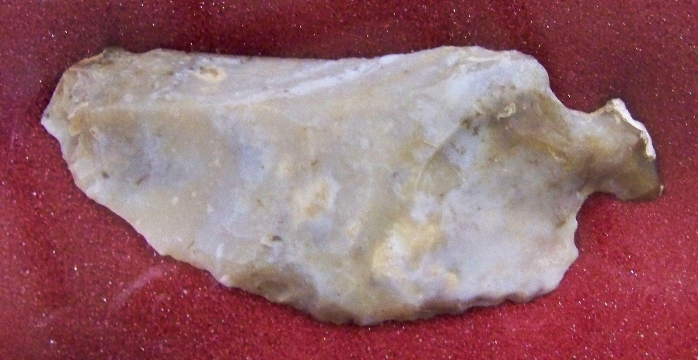
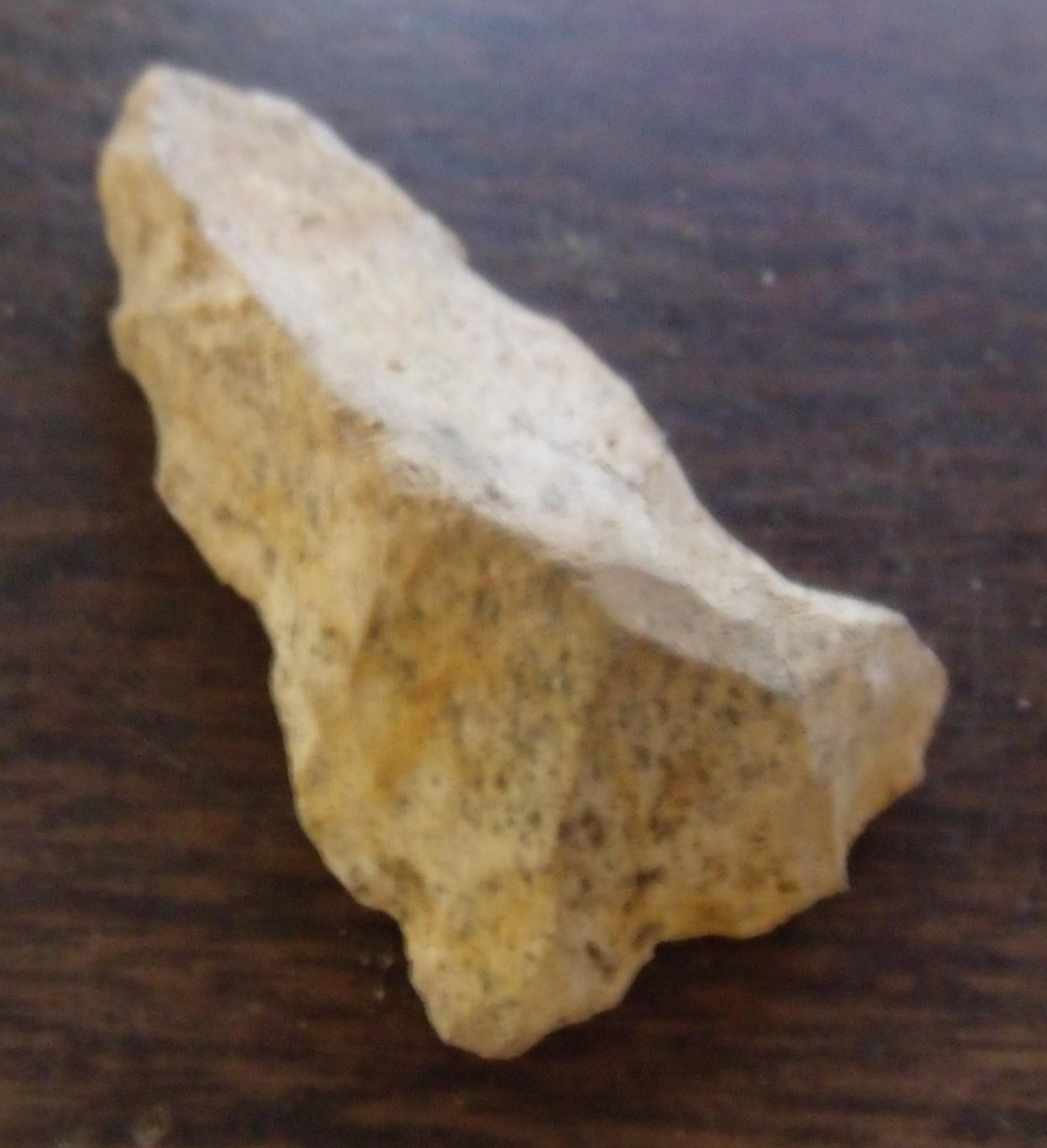
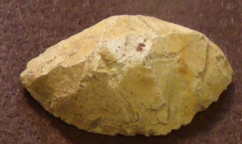
The site is located where county road 307 crosses Bull Branch Creek. Like so many other sites, the area had been clear-cut by loggers. The site contained only two identifiable artifacts, the Suwannee base pictured at the left and a dalton point.
The basal portion of the Suwannee-like point that was recovered at the site had the typical lateral thinning along the basal edge. The point had been worked into a perforating tool, but measured 1.25 inches in length by about 1 inch wide.
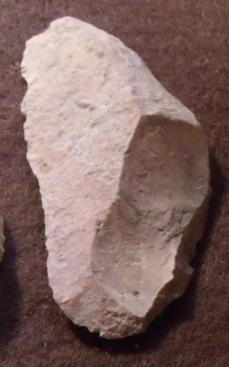
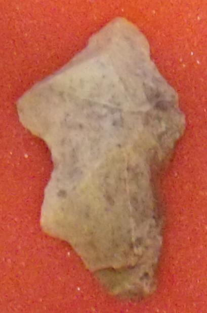
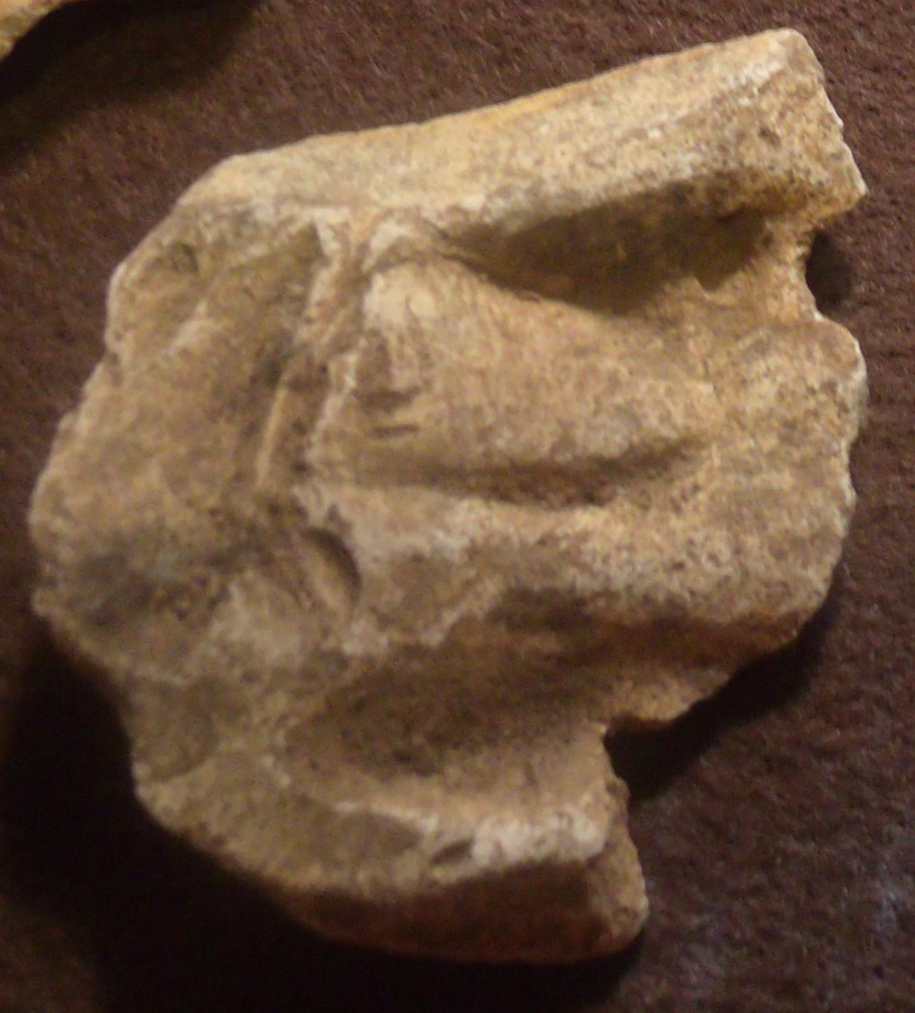
The Chalker site is located along Mayview-Chalker Road in Washington County. There is a cluster of three sites within just a few hundred yards of one another, the most productive of which was a site located near the property gate and very close to the banks of the Ogeechee River. That site yielded 390 artifacts.
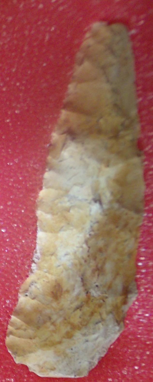
Among those artifacts was what appears to be a Simpson-like base that was part of the Middle Paleoindian period. The fragment measured 1.25 inches long and 1.5 inches wide at the tips of the basal ears. The fragment shows signs of being waisted and the basal ears are fairly pointed, which is typical of most Simpson points.
[i] Cambron, James W., and David C. Hulse, Handbook of Alabama Archaeology, Part 1, Point Types, David L. Dejarnette, editor,. Revised edition, Archaeological Research Association of Alabama, Birmingham, 1964
[ii] Bullen, Ripley P., A Guide To The Identification Of Florida Projectile Points, Revised Edition, Kendall Books, Page 47, 1975
[iii] Cambron, James W., and David C. Hulse, Handbook of Alabama Archaeology, Part 1, Point Types, David L. Dejarnette, editor,. Revised edition, Archaeological Research Association of Alabama, Birmingham, 1964
[iv] Dreves, Rick, Archaeological Investigations of 8-OR-17: An Early Aboriginal Campsite on the Shores of Lake Apopka, Florida, The Florida Anthropologist, Vol.27:2, 1974
[v] Bullen, Ripley P. and Lawrence E. Beilman, The Nalcrest Site, Lake Weohyakapkam, Florida, The Florida Anthropologist, Vol. 26:1, 1973:3
[vi] Bullen, Ripley P., A Guide To The Identification Of Florida Projectile Points, Revised Edition, Kendall Books, Page 56, 1975
[vii] Warren, Lyman O., A Possible Paleo-Indian Site in Pinellas County, Florida Anthropologist, 19:1, Page 40, 1966
[viii] Bonnichsen, Robson and Karen L. Turnmire, Clovis Origins. Clovis Origins and Adaptations, Center for the Study of the First Americans, Pages 316-317, 1991
[ix] Bullen, Ripley P., Some Thoughts on Florida Projectile Points, The Florida Anthropologist, Vol. 29:1, Page 33, 1976
[x] Warren, Lyman O., A Possible Paleo-Indian Site in Pinellas County, Florida Anthropologist, 19:1, Page 33, 1966
[xi] St. Augustine Herald, May 1995
[xii] Goggin, John M., Space and Time Perspectives in Northern St. Johns Archaeology, Florida, Academic Press, Inc., Page 64, 1952
[xiii] Bullen, Ripley P., Some Thoughts on Florida Projectile Points, The Florida Anthropologist, Vol. 29:1, Page 33, 1976
[xiv] Pollock, Phillip M., 300’ x 35 Mi. Corridor To The Past, Florida Department of State, 1986
[xv] Waller, Ben I.
1971 Hafted Flake Knives, The Florida Anthropologist, Vol. 24:4, 1971:173-174
[xvi] Willis, Craig
1988 Controlled Surface Collection of the Little River Rapids Site (8J2603): A Stratigraphically Deflated Site in the Aucilla River, North Florida, The Florida Anthropologist, Vol. 41:4,
[xvii] Willey, Gordon R.
1949 Archeology of the Florida Gulf Coast. Bureau of American Ethnology, Smithsonian Institution
[xviii] Cambron, James and David Hulse
1960 Alabama Archaeology