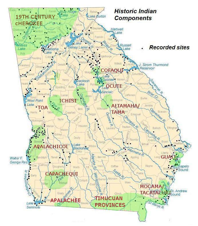
The entrance of Hernando Desoto into Georgia came at a time when the great ceremonial centers of the Middle and Late Mississippian period were declining and villages were scattered across the face of the state. The map below depicts the Native American settlements as they were distributed across Georgia by 1540. The map also depicts the approximate locations of Historic Indian components.
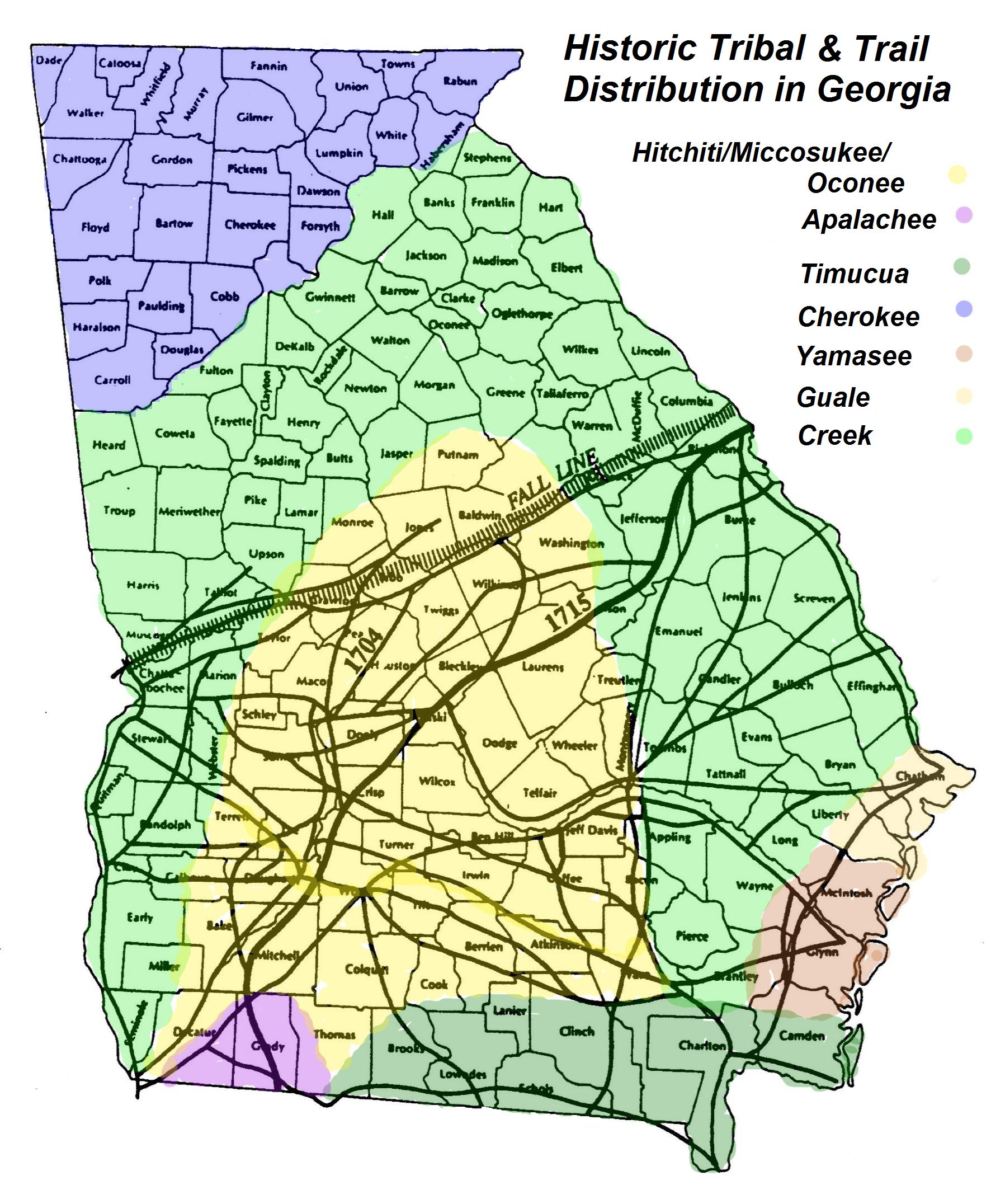
A maze of Indian trails connected many of these dots, making both trade and animosity possible. The following map shows the Indian trails of the Coastal Plain (after Hemperly 1979) and a more general look at the major Indian tribes identified in Georgia’s Historical period.
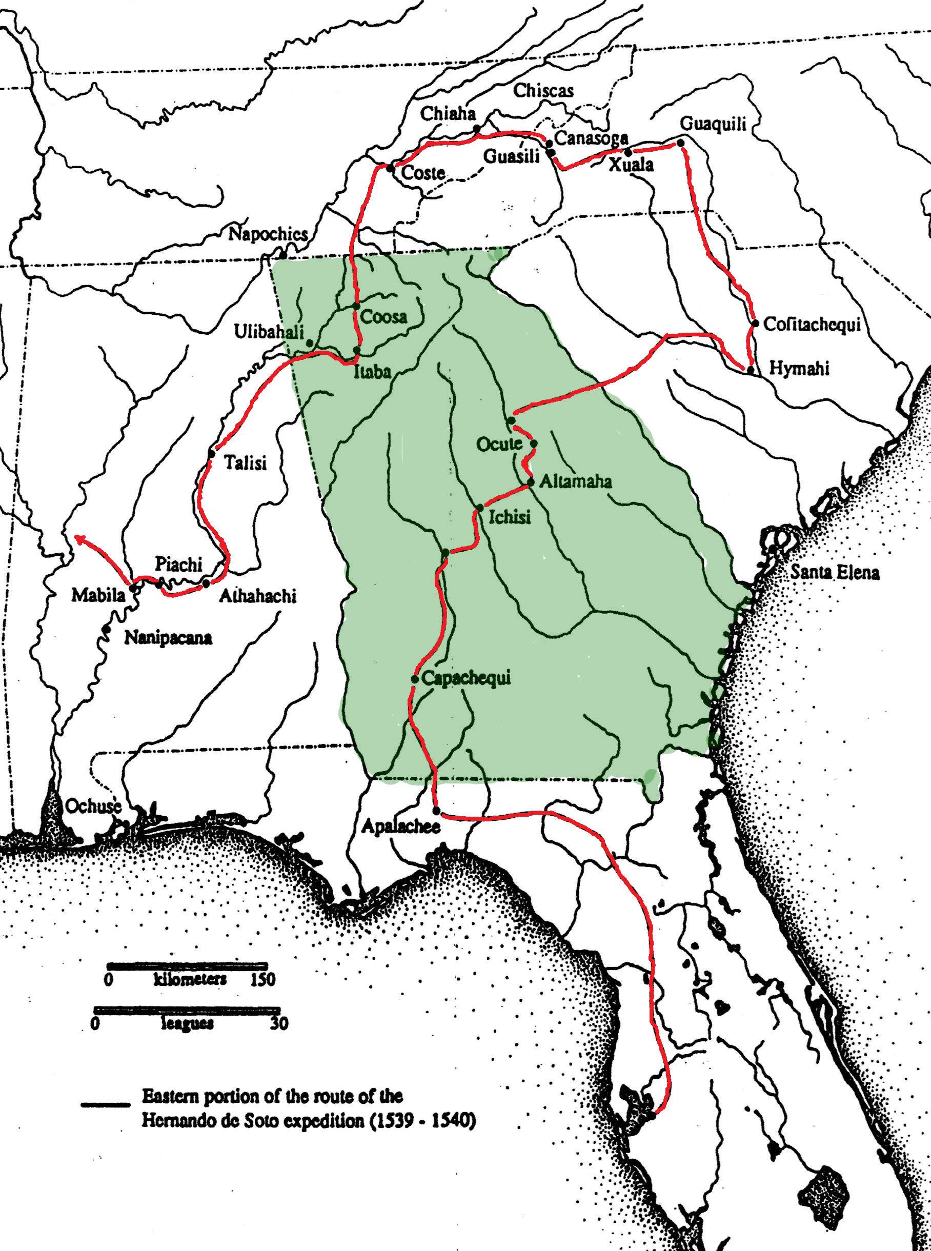
Desoto’s trek across Georgia connected several of these dots and appears to follow several of these main trails, much like today’s traveler would follow our current system of highways. The map below shows the suspected route of Desoto and some of the major towns and villages he visited along the way.
These maps serve as a general introduction to this period of history, but what are the specific details of each tribe? What of their artifacts they left behind?
Click on the picture that represents the tribe you would like to read more about.